
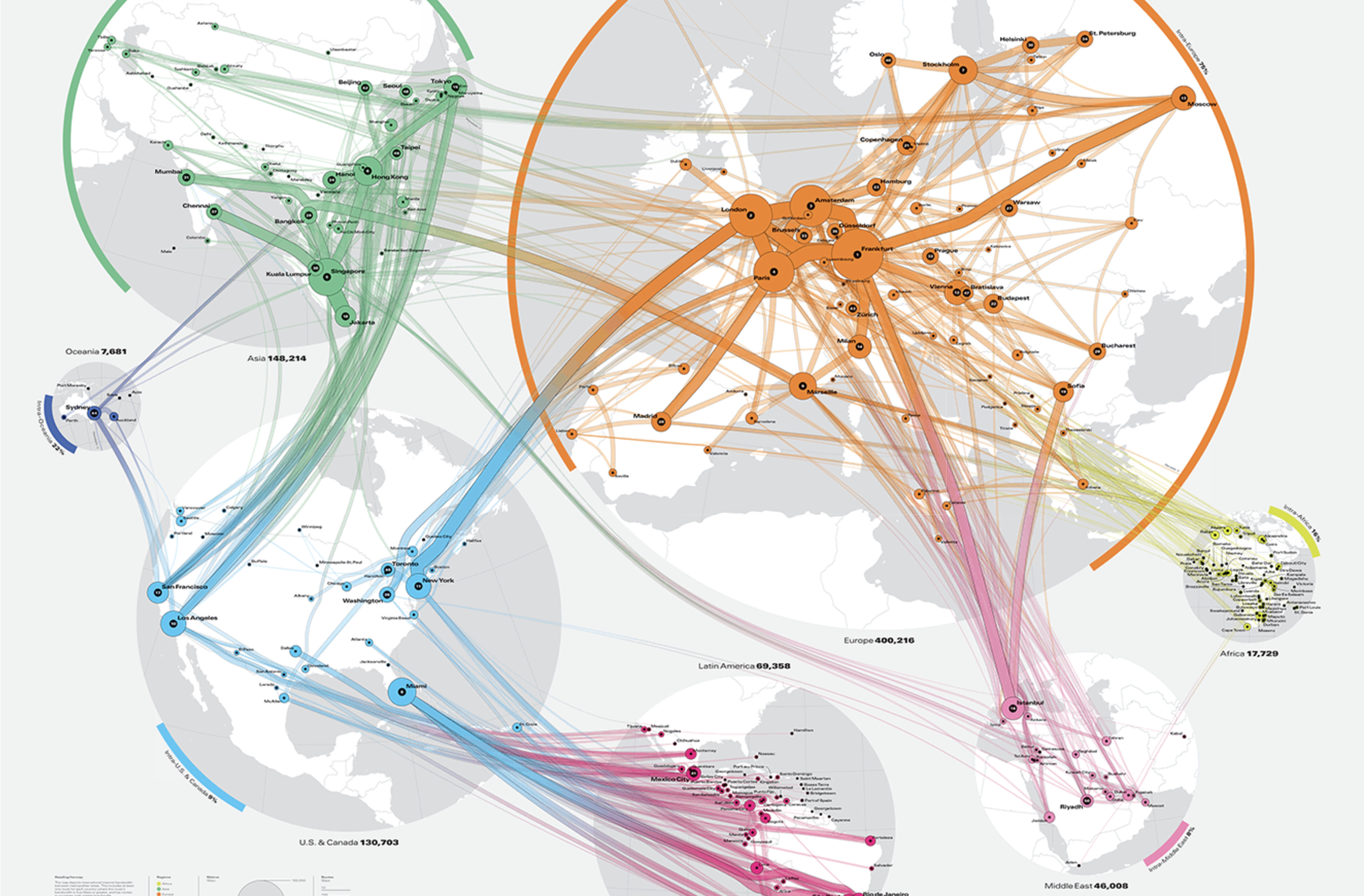
A geography-based connection map visualizes network relationships on top of geographic space. Nodes such as cities or locations are placed on a map, and edges connect them to show movement, communication, logistics, or other relationships.
Historical Background
The form is related to nineteenth-century flow maps and later airline route maps, communication network maps, and logistics maps. Modern GIS and network tools make it easy to overlay network structure on digital maps.
Use Cases
- Air routes
- Internet and communication cables
- Logistics and supply chains
- Migration or commuting connections
- Urban and regional networks
Design Notes
- Avoid too many overlapping edges.
- Use bundling or filtering for dense networks.
- Clarify whether line width represents volume.
- Preserve geographic context without overwhelming the network.
Summary
Geography-based connection maps are useful when the location of relationships matters. They combine network structure with geographic context.